The Georgia North Mountains loop runs through four adjacent counties — Lumpkin, Fannin, Stephens, Habersham — covering approximately 150 miles of mountain roads. Dahlonega, the starting point, has underground gold mines and the state's first gold rush town. Blue Ridge, 37 miles north, runs a scenic railway along the Toccoa River to the Tennessee state line. Toccoa, east across the mountains, has a 186-foot free-fall waterfall on a college campus and a mountain where WWII paratroopers trained for D-Day. Clarkesville closes the loop with one of the best waterfall hikes in North Georgia.
11 destinations selected from a curated US travel dataset — prioritized by regional distribution, visitor significance, and independent research. Must-see and Worth-the-detour ratings reflect relative value within Georgia.
Jump to: Dahlonega · Blue Ridge · Toccoa · Clarkesville · Planning Notes
Dahlonega
Dahlonega (Lumpkin County) is 70 miles north of Atlanta via GA-400 — 1.5 hours on a clear day. The 1828 Georgia Gold Rush started here, 20 years before California's. The town center is built around the original courthouse square, which now holds the Gold Museum.
Historic Dahlonega Square Must-see
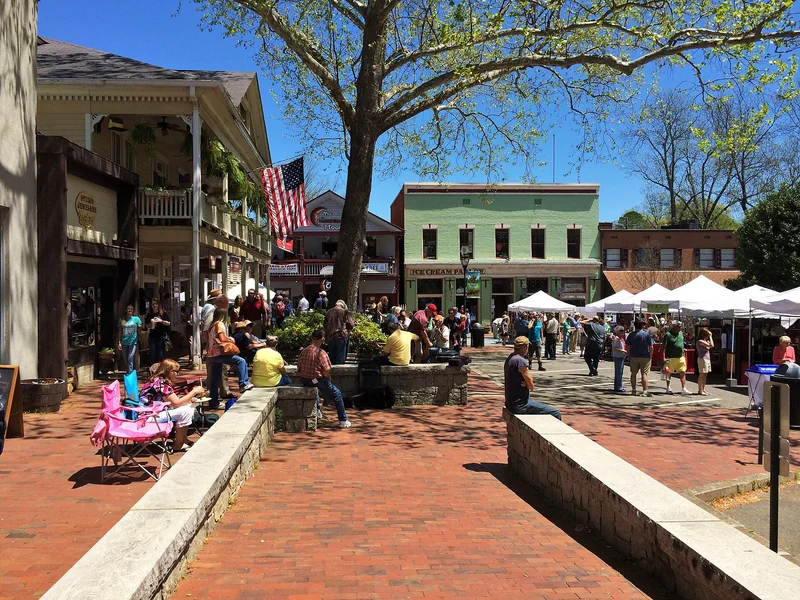
Lumpkin County · Dahlonega
The original courthouse square from 1833 — the commercial heart of the gold rush and the starting point for any Dahlonega visit. Gold leaf covers the dome of Price Memorial Hall on the University of North Georgia campus one block away (gilded with Dahlonega gold in 1836). The square has independent shops, wine tasting rooms, and restaurants within a short walk. Free to walk; parking available in town lots.
Watch on YouTube · View on Google Maps
Consolidated Gold Mine Must-see
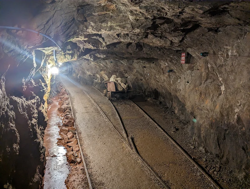
Lumpkin County · Dahlonega
Underground tours of the largest known gold-bearing ore vein in the eastern United States — a working mine opened in 1878 that operated until 1906. Guides lead visitors 200 feet underground through the main shaft, past original mining equipment and drill holes. Gold panning available after the tour. Located at 185 Consolidated Gold Mine Road, about 1 mile from the square. Paid admission; tours run on a schedule.
Watch on YouTube · View on Google Maps
Blue Ridge
Blue Ridge (Fannin County) is 37 miles north of Dahlonega via GA-60 N — about 1 hour on mountain roads. The town is positioned at the intersection of the Toccoa River and US-76 and built its identity around the scenic railway that's been running since 1905.
Blue Ridge Scenic Railway Must-see
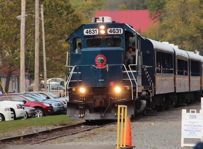
Fannin County · Blue Ridge
A 26-mile round-trip excursion train running from Downtown Blue Ridge to McCaysville on the Tennessee state line — along the Toccoa River through Fannin County mountain scenery. The journey is 1.5 hours each way; the train stops in McCaysville for 1–1.5 hours before returning. Multiple car classes including open-air cars for unobstructed mountain views. Trains run year-round; fall foliage (mid-October) is peak season. Book in advance — weekend trains sell out months ahead.
Watch on YouTube · View on Google Maps
Mercier Orchards Must-see
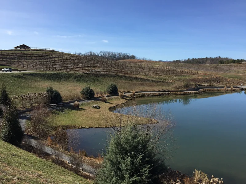
Fannin County · Blue Ridge
A 300-acre working apple orchard 3 miles north of Downtown Blue Ridge on Highway 5, open since 1943. The farm market sells 40+ apple varieties, apple cider, apple cider donuts, fried pies, and other farm products year-round. U-pick apples available in season (August through October). Free to enter the market and walk the grounds; U-pick and products are paid. The orchard is one of the highest-traffic stops in North Georgia in fall.
Watch on YouTube · View on Google Maps
Downtown Blue Ridge Must-see
Fannin County · Blue Ridge
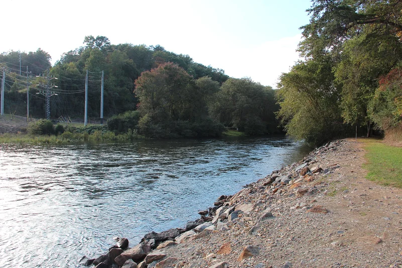
A walkable downtown along East Main Street with independent restaurants, galleries, antique shops, and wine bars. The commercial district is designed around the railway depot and the weekend visitor trade — most businesses are within 3 blocks of the train station. Free to walk; parking is available on side streets. The Toccoa River is accessible at multiple points near downtown for bank fishing and kayak put-ins.
Watch on YouTube · View on Google Maps
McCaysville Historic District (Georgia-Tennessee State Line Town) Worth the detour
Fannin County · McCaysville
The scenic railway's northern terminus — a small town where Main Street crosses the Georgia-Tennessee state line, with a painted boundary line on the pavement dividing McCaysville, Georgia from Copperhill, Tennessee. The towns grew up around copper mining beginning in the 1840s. Walking from the train depot to the state line and into Copperhill is the standard 1-hour layover during the railway trip. Accessible by car 15 miles north of Blue Ridge via US-76.
Watch on YouTube · View on Google Maps
Toccoa River Scenic Area Must-see
Fannin County · Blue Ridge
The Toccoa River runs 20 miles from its headwaters in Union County through Fannin County before entering Tennessee as the Ocoee River. The Blue Ridge section offers bank fishing, tubing, and kayaking from multiple access points — Deep Hole Recreation Area and Sandy Bottoms being the main public put-ins. The river is a designated Georgia Wild and Scenic River for its upper section. Free access at public areas; outfitters in Blue Ridge offer tube and kayak rentals for the 4–6 mile float sections.
Watch on YouTube · View on Google Maps
USA Travel Planner — Google Sheets
One purchase. Every US state. Forever.
A pre-filled travel dashboard for every US state — we are actively building them out.
- 75+ curated attractions — pre-researched for you
- Built-in budget tracker (countdown, expenses, remaining)
- Step-by-step planning tabs
- Buy once — get all future states free as they launch
Toccoa
Toccoa (Stephens County) is approximately 65 miles east of Blue Ridge via US-76 E and US-441 S — 1.5 to 2 hours on mountain roads. The drive through Rabun County passes near Tallulah Gorge (a strong detour option). Toccoa is defined by two outsized landmarks: a 186-foot waterfall on a college campus and a mountain where WWII paratroopers trained.
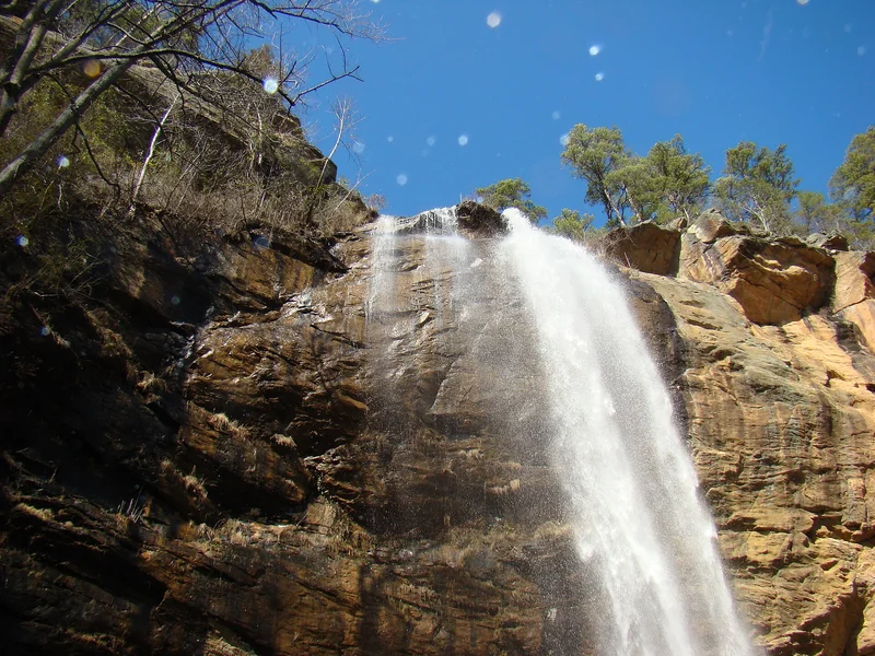
Toccoa Falls Must-see
Stephens County · Toccoa
A 186-foot free-fall waterfall on the campus of Toccoa Falls College — taller than Niagara Falls by 19 feet, and one of the highest free-fall waterfalls east of the Mississippi. The falls drop in a single unbroken curtain into a pool at the base of a narrow gorge. The college charges a small admission fee to access the trail, which is less than 5 minutes from the parking area. Open daily.
Watch on YouTube · View on Google Maps
Currahee Military Museum (Band of Brothers) Must-see

Stephens County · Toccoa
A museum dedicated to the 506th Parachute Infantry Regiment's WWII training at Camp Toccoa and subsequent combat in Europe. Exhibits include uniforms, equipment, photographs, and personal accounts from the men who trained here before Normandy, Operation Market Garden, and the Battle of the Bulge. Located at 160 N. Alexander Street in Downtown Toccoa. Paid admission.
Watch on YouTube · View on Google Maps
Clarkesville
Clarkesville (Habersham County) is 28 miles south of Toccoa via US-441 — about 40 minutes. It closes the loop: Clarkesville to Dahlonega is 25 miles via GA-115 W (45 minutes), completing the circuit. Clarkesville to Atlanta directly is 80 miles via I-985/GA-365 (1.5 hours).
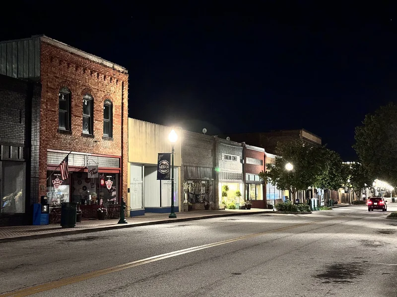
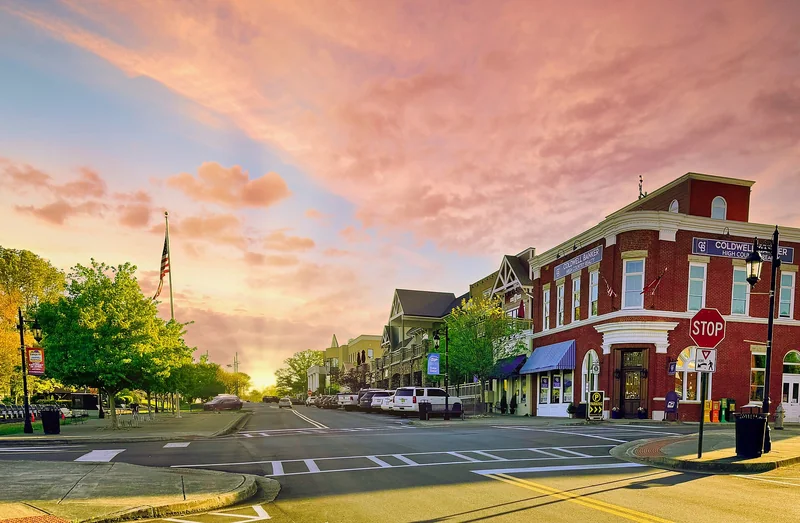
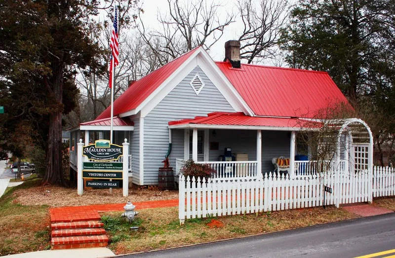
Historic Downtown Clarkesville Must-see
Habersham County · Clarkesville
A small Victorian downtown on the National Register of Historic Places — a Victorian commercial streetscape on the National Register of Historic Places, with 19th-century storefronts on Washington Street in active use. Independent restaurants, galleries, and antique shops line Washington Street. The downtown is walkable in 30 minutes. The town square holds Grace Episcopal Church (1838), one of the oldest operating churches in North Georgia. Free to walk.
Watch on YouTube · View on Google Maps
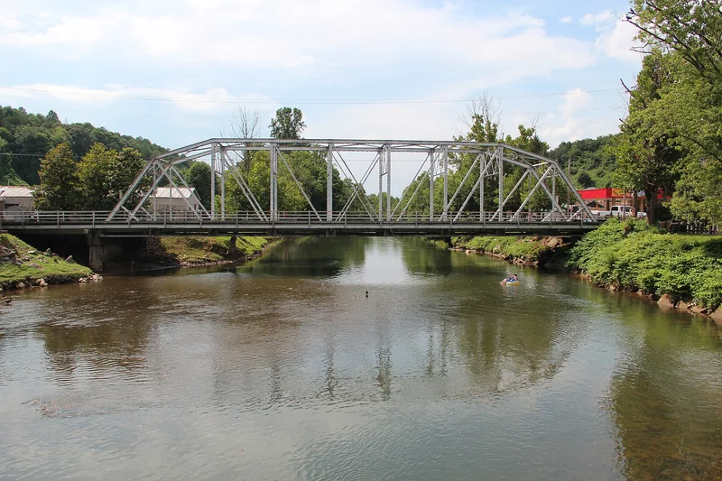
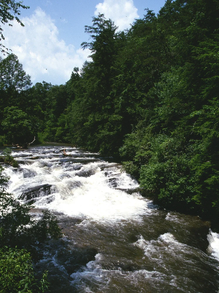
Soque River Corridor Worth the detour
Habersham County · Clarkesville
The Soque River flows south through Habersham County from its headwaters in White County — a native brook trout stream considered one of the premier fly-fishing rivers in Georgia. Public access points along the lower corridor allow bank fishing and wading. The river is cold, clear, and fast-moving year-round; water levels are best for wading in late summer and fall. Free at public access points; guided fishing trips available through outfitters in Clarkesville.
Watch on YouTube · View on Google Maps
Planning Notes
Route summary: Atlanta (GA-400 N) → Dahlonega (70 mi, 1.5 hr) → Blue Ridge (GA-60 N, 37 mi, 1 hr) → Toccoa (US-76 E then US-441 S, ~65 mi, 1.5–2 hr) → Clarkesville (US-441 S, 28 mi, 45 min) → Atlanta (I-985/GA-365, 80 mi, 1.5 hr). Total circuit: ~290 miles from Atlanta.
2-day version: Day 1 — Dahlonega and Blue Ridge (base in Blue Ridge cabin or downtown Dahlonega). Day 2 — Toccoa and Clarkesville, return to Atlanta via I-985.
3-day version: Day 1 — Dahlonega. Day 2 — Blue Ridge (full day for railway, Mercier, downtown). Day 3 — Toccoa morning, Clarkesville afternoon, return to Atlanta via I-985.
Tallulah Gorge detour: Between Blue Ridge and Toccoa, US-76 E passes within 8 miles of Tallulah Gorge State Park in Rabun County — one of the deepest gorges in the eastern US. Add 30 minutes to the drive from Blue Ridge to Toccoa to include the gorge overlook.
Accommodation: Blue Ridge has the most vacation cabin inventory in North Georgia; booking fills months ahead for fall foliage season (mid-October). Clarkesville has several B&Bs. Dahlonega has a small hotel cluster near the square. Toccoa is mostly chain motels off US-123.
Plan your visit: Explore city guides for every destination in this article: Dahlonega, Blue Ridge, Toccoa, Clarkesville.